James Qualtrough
State of Nature 2024 - Terrestrial Overview
Located in the centre of the Irish Sea, the Isle of Man has a total of 572 square kilometres of terrestrial habitat, from its highest peak at the summit of Snaefell (621m) to the northern plains of the Ayres.
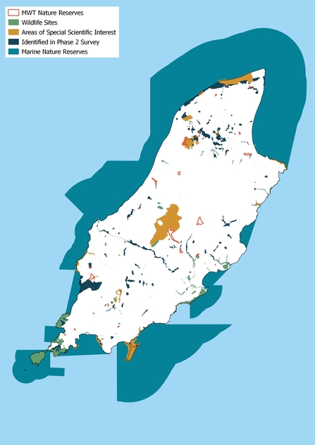
We have 28 nature reserves comprising 0.8% of Manx lands and are the only entire nation in the world to have UNESCO Biosphere Status.
Current data regarding the conservation status of our native plant and bird species provides a clear indication of the health of our valuable terrestrial habitats.
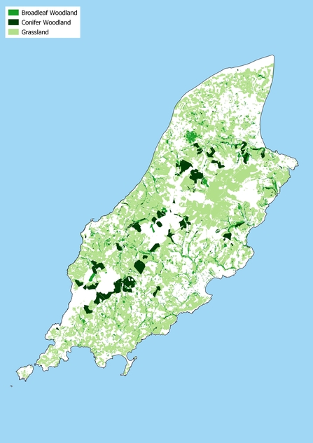
Woodland cover started to increase from tiny fragments around 1750, with many small woodlands planted for the next 150 years, but it was not until the 20th century that woodland cover really started to increase. Most of this woodland was established on species-rich habitats, so its ecological effects were as damaging as they were positive. New woodland continues to be established and the Island is set to reach 10% woodland cover in the next few years. Fortunately new woodlands are ecologically assessed before planting to ensure biodiversity net gain.
Woodland pasture, rewilding, short-rotation native forestry and planting native woodlands for old-growth forests are recommended for future woodlands.
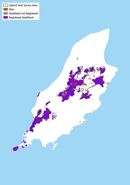
Of the peatland surveyed so far, there are 2091 hectares of peat over 40cm and 228 hectares of peat over 1m. This amount is likely to be substantially higher once Ballaugh Curragh, the central valleys and other known peatland areas are included in the survey.
The volume of peat over 40cm is approx. 15,474,503 m3
The carbon stored in this peat is approx. 1,547,450 tonnes
The estimated emissions from damaged upland peat over 40cm are 5636 tonnes of CO2 equivalent per year - equivalent to that from 430 people!


